Creating Resilient Communities Through Smart Floodplain Management
Resilience is:
the capacity to survive, adapt, and thrive in the face of chronic stresses and acute shocks, and even transform when conditions require it.
Resilience is being strong in a world where things go wrong.
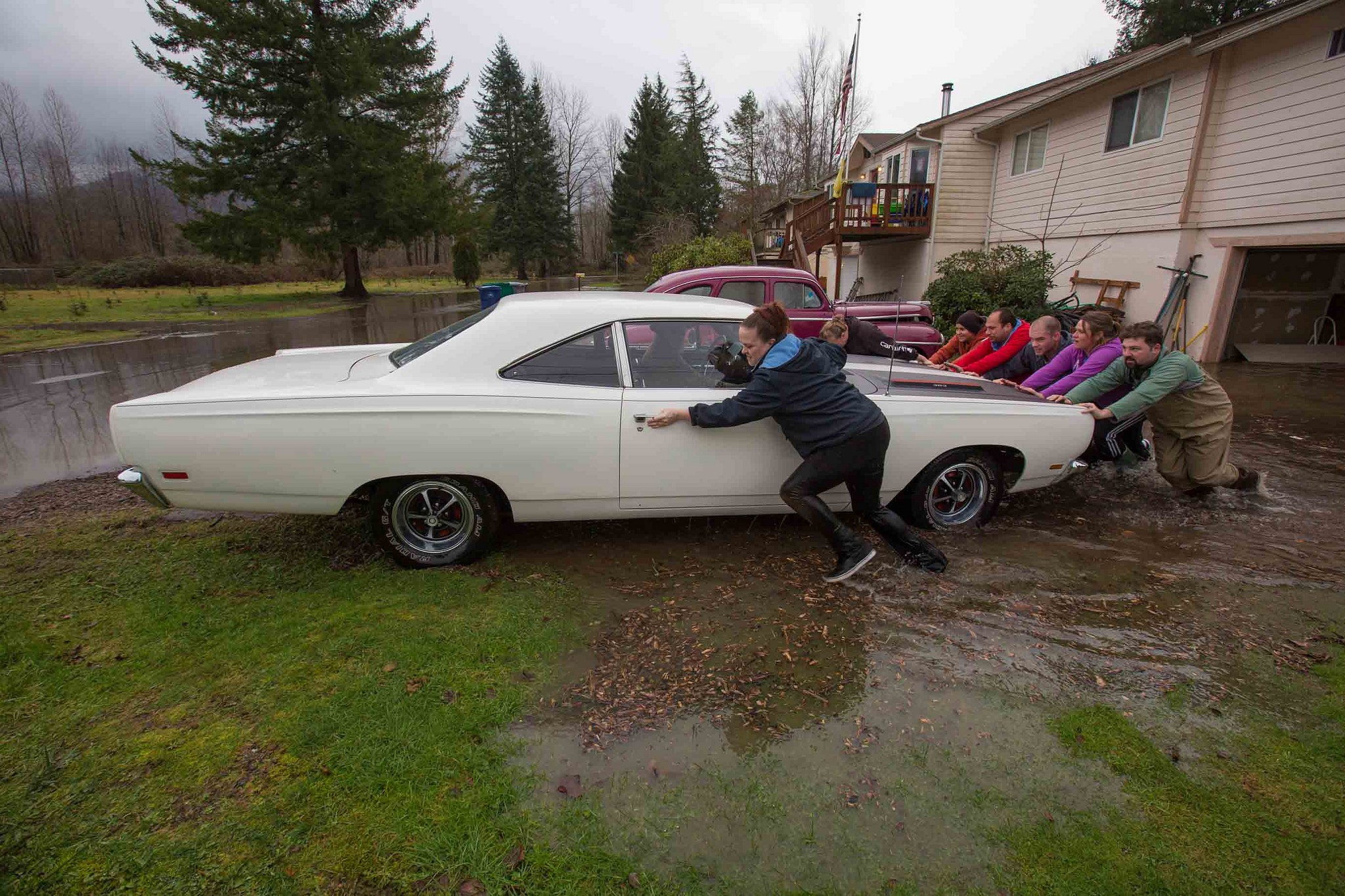
Our changing climate will continue to lead to changing patterns in weather and other natural systems. Warmer, earlier spring rains are pushing rivers over their banks and into homes, businesses and transportation centers. As the effects of climate change unfold, unexpected events, like floods, are likely to occur.
but…
Climate impacts are not determined by climate alone
Calculating the risk of something catastrophic happening to these human populations is a matter of multiplying potential hazards by potential consequences.

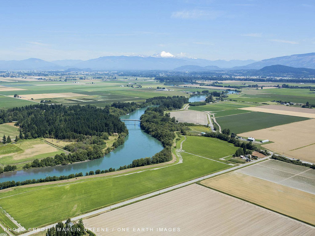
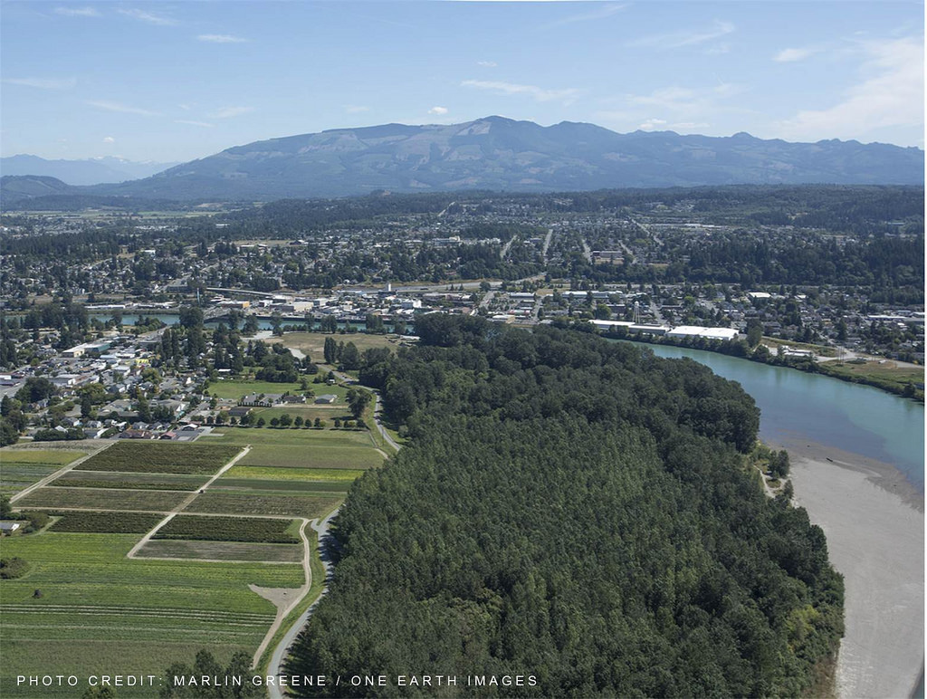
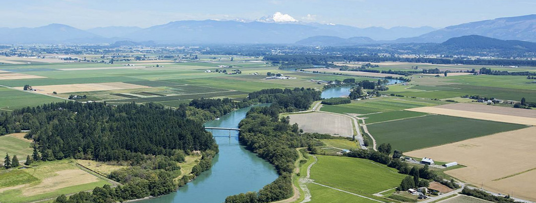
Washington’s major rivers run from forested headwaters through farmland, rural, urban and industrial areas.
Resilience in the context of floodplain management
Reducing risk and improving resilience is a key component of the work underway and in planning from the Floodplains by Design partnership. Below are two examples of the integrated, system-wide approach championed by Floodplains by Design.
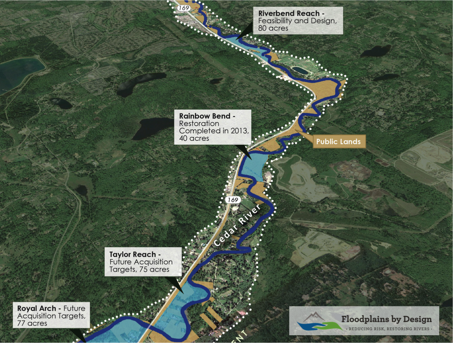
- Acquisition of up to 15 properties (approximately 45 acres) and removal of 14-15 homes from
the floodplain to make way for future restoration on 232 acres. - The Riverbend project design, when implemented, would add 49 acre-feet of flood storage,
resulting in 100-year floods that are lower and slower and therefore less erosive, improving flood
protection to an additional 12 homes and 19 parcels worth $4.6 million assessed value. - Project actions to be designed and permitted will also improve habitat over a 0.8 mile length,
including 1900 feet of new side channel habitat.
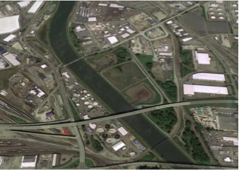
Cedar River Corridor Plan
This plan includes a high priority reach for flood risk reduction and salmon habitat restoration.
Floods affect homes, critical transportation infrastructure and associated fiber optic cable, a community trail, and the City of Renton downstream. Since 1993, King County has spent $900,000 in flood repairs at the proposed project sites, including $450,000 in the last two floods. Planning for and addressing flooding and habitat needs simultaneously will protect public safety, restore salmon and save money over the long term.
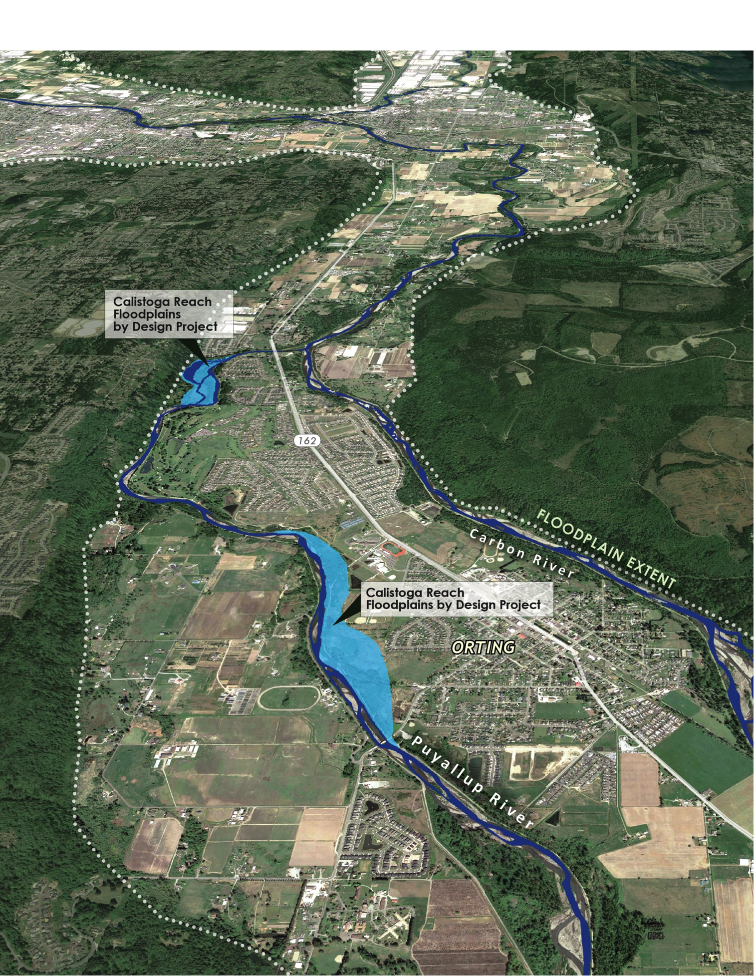
Calistoga Reach Project
The City of Orting used to suffer major Puyallup River flooding almost every year, despite the presence of a levee meant to protect the city. Roads and highways become inundated, shutting down traffic into, out of and through town. Increased sedimentation in the river impaired salmon habitat downstream.
In response, a partnership between local government, state agencies, The Nature Conservancy and the Puyallup Tribe stepped in to take action. Moving and strengthening the levee reconnected 42 acres of floodplain, thus protecting Orting from future flooding by providing the river more room. The project is already paying dividends, as the levee survived a major storm in January 2015, keeping Orting high and dry. Just downstream, Pierce County is restoring 100 acres of floodplain forest habitat and reconnecting side channel habitat. Carefully designed logjams will create habitat for chinook salmon, bull trout and steelhead. When completed, this side channel will be the longest on the Puyallup River and have water flows year-round.